Via Ferrata-Αναρρίχηση-Trekking 5 days Epirus
- ExperienceBeginner
- LocationVikos,Drakolimni,Gamila, Meteora Greece
- Duration5 days
- Opening SeasonMay up to October
- Spoken LanguagesGreek English
Description
Via Ferrata-Climbing 5 Days Konitsa,Papigo,Astraka,Meteora, Epirus, Greece
(contact us for availability)Konitsa - Via Ferrata
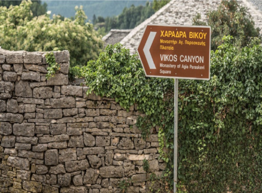
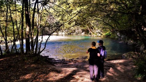
Vikos Gorge - Crossing
Papigo - Mountain Shelter - Drakolimni Tymfi
Astraka - Gamila Shelter
Meteora Climbing
-
Participants up to 20
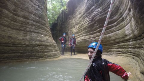
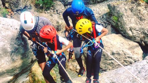
Day 1 : Konitsa - Via Ferrata in the ravine of Aoos
Via Ferrata runs along the banks of the Aoos River. The route starts from its old bridge
Konitsas and ends at the same point.
The route includes two bridges, a small one in Gravo 6-7 meters long with ropes and
stairs and the Tibetan of Aoos 17 meters long at a height of 35 meters above the river !! The rest
route has tracks with easy walking in enchanting landscapes, short tracks with Via Cordata, stairs
on the slope and pieces of the original Via Ferrata moving on metal stairs in vertical
rock even 60-70 meters above the water !!
A special activity with an extreme character that does not require previous experience, but nevertheless
presupposes the lack of height phobia. The physical condition required for the activity is moderate
level.
VIA FERRATA DETAILS:
• Route approach: gentle 45 minute walk
• Duration of activity: 4-5 hours
• Provision of Special equipment required for via ferrata (helmets, bontrie, special "expansion" belt
• Free photo and video
• Necessary equipment from you hiking shoes, small backpack, headlight, individual
pharmacy.
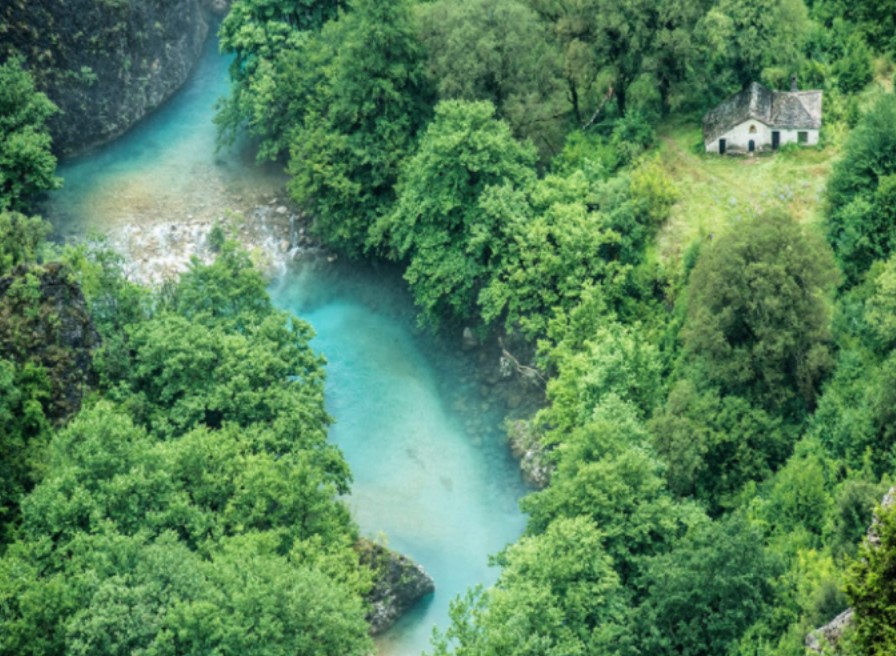
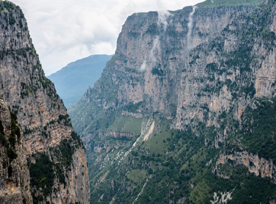
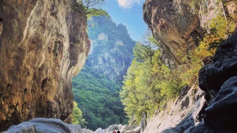
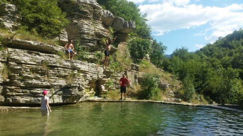
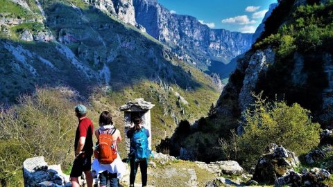
2nd Day: Vikos Gorge
The area of Vikos-Aoos is located north of the city of Ioannina, in the northwestern part of Zagori,
on the border with Konitsa and was established as a National Park in 1973. The gorge of Vikos is located in
core of the area, It extends from the villages of Monodentri and Koukouli, to the bridge of Klidonia.
This is a magical location with great ecological value. After all, it is in the Guinness Book
to the gorge with the smallest opening, just 1100 meters at its narrowest point and at the same time depth
exceeding 900 meters. It is one of the deepest gorges in the world.
It has a length of 10 km and vertical, steep and rocky slopes, overgrown with rare flowers and
herbs. Its width ranges from 30 to 100 meters. The river that crosses it, Voidomatis, has water
from November to June.
The area is one of the most important ecosystems due to the rare flora and fauna. THE
the geographical isolation of the area, the relatively small human impact and the great diversity
habitat types and microclimatic conditions, favor the growth of different plant species. So,
the area is a place where many rare plants are collected and preserved. Several of them
are considered endangered species.
WHAT I SHOULD HAVE WITH ME:
• Comfortable sports / hiking clothes
• Hiking shoe or boot (NO sneakers)
• Backpack for essentials
• Hermit crab with water / snack
• Hat, sunscreen
• Baton
• Head lens
• Private pharmacy
• Waterproof
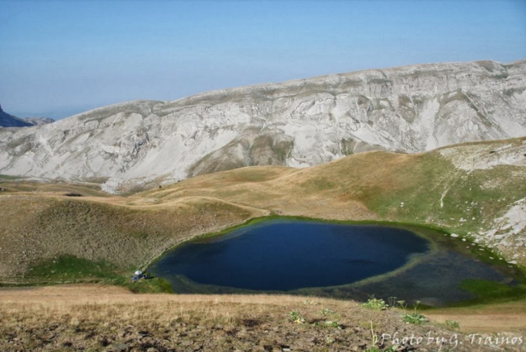
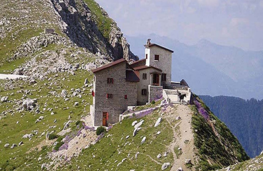
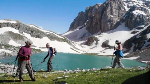
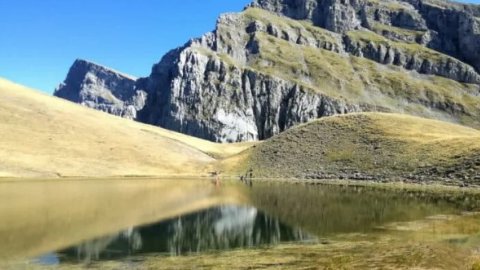
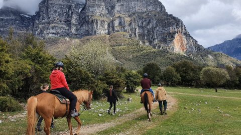
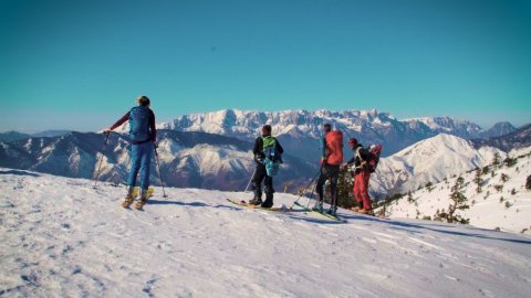
Day 3 : Papigo-mountain refuge-dragon lake Tymfis
The path to the shelter of Astraka starts from Mikro Papigo and is marked,
preserved and distinct. The route at the beginning passes through a wooded area, soon the landscape
is stripped naked and we enter the Alpine zone of Tymfi. It moves east and leads to
3 hours to the shelter of Astraka passing by four springs.
Avragonio just outside the village, Antalki where the water is told by the local legend that it comes from
Abyss of Provatina, Trafo just before the crossroads for Astraka and finally Kruna just before
the final uphill for the renovated shelter, in the col of Astraka.
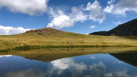
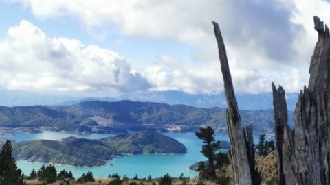
Northeast of the shelter is a plateau at an altitude of about 1750m, Lakka Tsoumani, where the sheepfold of the Tsoumani family is located 20 minutes from the shelter. Small lakes are formed there, which dry up in late summer. The largest is Xeroloutsa. Crossing the plateau in a northeast direction and passing by a spring, after 1 hour and at an altitude of about 2050m, there is the famous Drakolimni, in the waters of which live the newts (triturus alp-estris) that survive the winter falling into hibernation.
This hiking trail requires very good physical condition. It is probably the most famous mountaineering
route of the area. Its length is 9 km and it takes about 5-6 hours for Drakolimni. In
along the way there are several springs with drinking water, while the path leads to alpine meadows and plateaus.
In the middle of the route is the shelter where overnight will be.
WHAT I SHOULD HAVE WITH ME:
• Comfortable sports / hiking clothes
• Hiking shoe or boot (NO sneakers)
• Backpack for essentials
• Hermit crab with water / snack
• Hat, sunscreen
• Baton
• Head lens
• Private pharmacy
• Waterproof
• Sleeping bag
• Personal hygiene items / face towel / toilet paper
• Slippers for the shelter
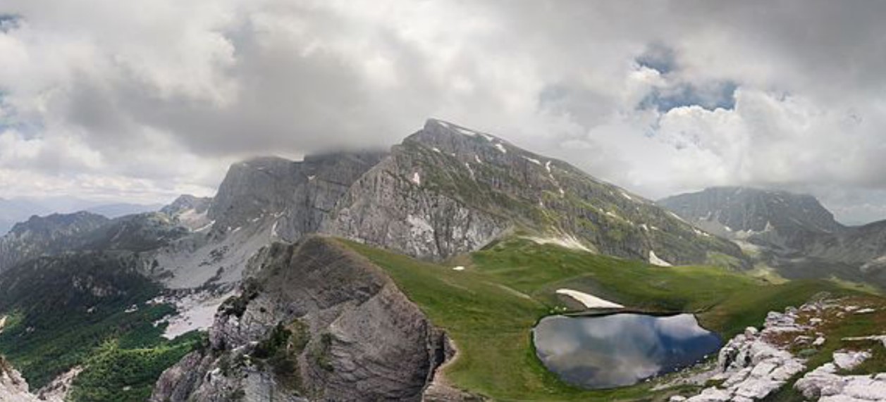
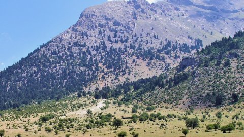
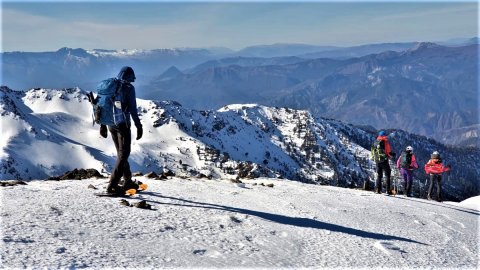
4th Day shelter Astrakas-Tymfi Gamila
The route starts from the shelter located at 1950m and ends after 5 km and
Approximately 2.30-3.00 hours at the top of Gamila, at 2497m.
This is a route that the view from the top takes the visitor's breath with its slopes
Camels fall vertically into the ravine of the river Aoos that opens in front of us. Across
the mountain range of Smolikas emerges and Drakolimni can be seen in the lower west. The spectacle is
so impressive that it definitely pays off. You will be impressed by the beautiful alpine
landscape and unspoiled nature!
WHAT I SHOULD HAVE WITH ME:
• Comfortable sports / hiking clothes
• Hiking shoe or boot (NO sneakers)
• Backpack for essentials
• Hermit crab with water / snack
• Hat, sunscreen
• Baton
• Head lens
• Private pharmacy
• Waterproof
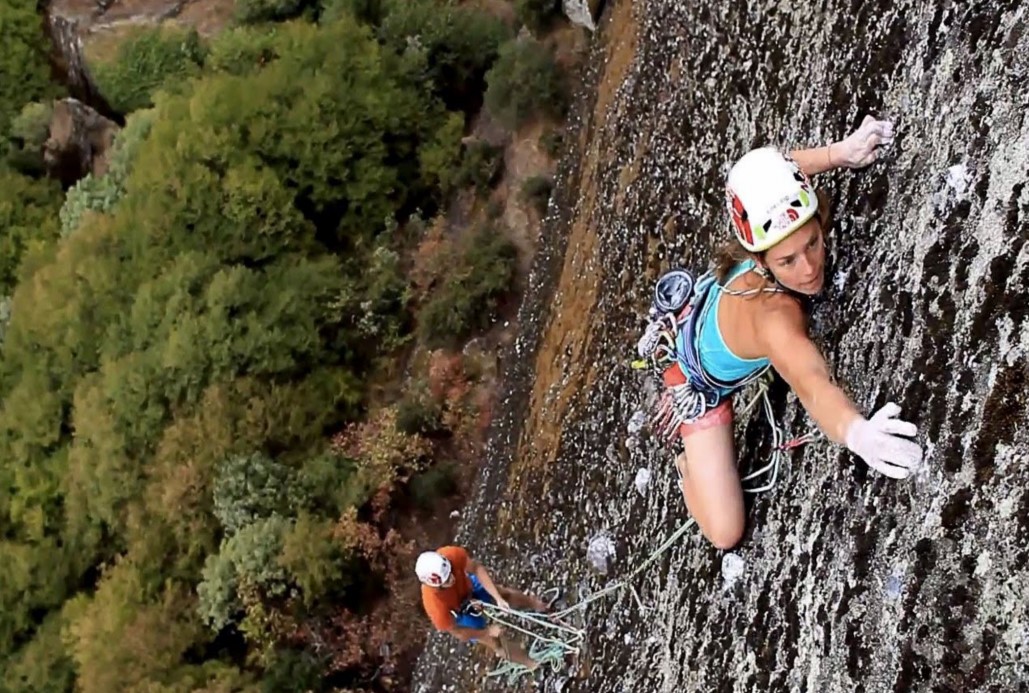
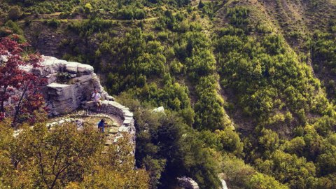
Day 5 Climbing the rocks of Meteora
Whether you are new to climbing or an experienced climber, this activity is an adventure.
in Meteora that you should not miss. Leave one of the professional, experienced trainers to you
Take a tour of the local slopes and climb along some of the best routes it has
to offer the area of Meteora !!
Recommended equipment:
• Comfortable casual clothes
• Mountaineering shoes or sports shoes are required. Sandals or open-toed shoes are not suitable
• Waterproof coat
• Sunglasses
• Water (at least 1 liter)
• Camera
• Backpack
Via Ferrata runs along the banks of the Aoos River. The route starts from its old bridge
Konitsas and ends at the same point.
The route includes two bridges, a small one in Gravo 6-7 meters long with ropes and
stairs and the Tibetan of Aoos 17 meters long at a height of 35 meters above the river !! The rest
route has tracks with easy walking in enchanting landscapes, short tracks with Via Cordata, stairs
on the slope and pieces of the original Via Ferrata moving on metal stairs in vertical
rock even 60-70 meters above the water !!
A special activity with an extreme character that does not require previous experience, but nevertheless
presupposes the lack of height phobia. The physical condition required for the activity is moderate
level.
VIA FERRATA DETAILS:
• Route approach: gentle 45 minute walk
• Duration of activity: 4-5 hours
• Provision of Special equipment required for via ferrata (helmets, bontrie, special "expansion" belt
• Free photo and video
• Necessary equipment from you hiking shoes, small backpack, headlight, individual
pharmacy.
2nd Day: Vikos Gorge
The area of Vikos-Aoos is located north of the city of Ioannina, in the northwestern part of Zagori,
on the border with Konitsa and was established as a National Park in 1973. The gorge of Vikos is located in
core of the area, It extends from the villages of Monodentri and Koukouli, to the bridge of Klidonia.
This is a magical location with great ecological value. After all, it is in the Guinness Book
to the gorge with the smallest opening, just 1100 meters at its narrowest point and at the same time depth
exceeding 900 meters. It is one of the deepest gorges in the world.
It has a length of 10 km and vertical, steep and rocky slopes, overgrown with rare flowers and
herbs. Its width ranges from 30 to 100 meters. The river that crosses it, Voidomatis, has water
from November to June.
The area is one of the most important ecosystems due to the rare flora and fauna. THE
the geographical isolation of the area, the relatively small human impact and the great diversity
habitat types and microclimatic conditions, favor the growth of different plant species. So,
the area is a place where many rare plants are collected and preserved. Several of them
are considered endangered species.
WHAT I SHOULD HAVE WITH ME:
• Comfortable sports / hiking clothes
• Hiking shoe or boot (NO sneakers)
• Backpack for essentials
• Hermit crab with water / snack
• Hat, sunscreen
• Baton
• Head lens
• Private pharmacy
• Waterproof
Day 3 : Papigo-mountain refuge-dragon lake Tymfis
The path to the shelter of Astraka starts from Mikro Papigo and is marked,
preserved and distinct. The route at the beginning passes through a wooded area, soon the landscape
is stripped naked and we enter the Alpine zone of Tymfi. It moves east and leads to
3 hours to the shelter of Astraka passing by four springs.
Avragonio just outside the village, Antalki where the water is told by the local legend that it comes from
Abyss of Provatina, Trafo just before the crossroads for Astraka and finally Kruna just before
the final uphill for the renovated shelter, in the col of Astraka.
Northeast of the shelter is a plateau at an altitude of about 1750m, Lakka Tsoumani, where the sheepfold of the Tsoumani family is located 20 minutes from the shelter. Small lakes are formed there, which dry up in late summer. The largest is Xeroloutsa. Crossing the plateau in a northeast direction and passing by a spring, after 1 hour and at an altitude of about 2050m, there is the famous Drakolimni, in the waters of which live the newts (triturus alp-estris) that survive the winter falling into hibernation.
This hiking trail requires very good physical condition. It is probably the most famous mountaineering
route of the area. Its length is 9 km and it takes about 5-6 hours for Drakolimni. In
along the way there are several springs with drinking water, while the path leads to alpine meadows and plateaus.
In the middle of the route is the shelter where overnight will be.
WHAT I SHOULD HAVE WITH ME:
• Comfortable sports / hiking clothes
• Hiking shoe or boot (NO sneakers)
• Backpack for essentials
• Hermit crab with water / snack
• Hat, sunscreen
• Baton
• Head lens
• Private pharmacy
• Waterproof
• Sleeping bag
• Personal hygiene items / face towel / toilet paper
• Slippers for the shelter
4th Day shelter Astrakas-Tymfi Gamila
The route starts from the shelter located at 1950m and ends after 5 km and
Approximately 2.30-3.00 hours at the top of Gamila, at 2497m.
This is a route that the view from the top takes the visitor's breath with its slopes
Camels fall vertically into the ravine of the river Aoos that opens in front of us. Across
the mountain range of Smolikas emerges and Drakolimni can be seen in the lower west. The spectacle is
so impressive that it definitely pays off. You will be impressed by the beautiful alpine
landscape and unspoiled nature!
WHAT I SHOULD HAVE WITH ME:
• Comfortable sports / hiking clothes
• Hiking shoe or boot (NO sneakers)
• Backpack for essentials
• Hermit crab with water / snack
• Hat, sunscreen
• Baton
• Head lens
• Private pharmacy
• Waterproof
Day 5 Climbing the rocks of Meteora
Whether you are new to climbing or an experienced climber, this activity is an adventure.
in Meteora that you should not miss. Leave one of the professional, experienced trainers to you
Take a tour of the local slopes and climb along some of the best routes it has
to offer the area of Meteora !!
Recommended equipment:
• Comfortable casual clothes
• Mountaineering shoes or sports shoes are required. Sandals or open-toed shoes are not suitable
• Waterproof coat
• Sunglasses
• Water (at least 1 liter)
• Camera
• Backpack
What it includes:
• 2 nights in a traditional hotel in Monodendri, 1 day stay in
Astraka shelter and 1 day accommodation in a hotel in Kastraki
• Breakfast every day
• Max group size: 20
• Via Ferrata
• 3 days hiking
• Climbing
• The necessary equipment for Via Ferrta and for climbing
• Greek International Mountain Guide
• Quality photos / videos - taken with a drone
• Organized and coordinated by Adventure Club
• Insurance
What does NOT include:
• Transportation (possibility to move with MINI BUS after discussion)
• Drinks, Meals
• Various personal expenses
Meeting Point:
If you are leaving Athens, the meeting point will be arranged with your guide.
If you are close to the excursion areas, the meeting point will be in Konitsa.
In both cases, the exact meeting point will be arranged with your driver.
Equipment List
Day Backpack 30 - 40 liters
• Hiking shoes
• Socks (preferably woolen)
• Underwear
• Hiking pants
• Waterproof Jacket
• Isothermal
• Fleece Jacket
• Hiking poles
• Gloves
• Hat / Buff
• Sunglasses
• Sun cream
• Personal hygiene items
• Water bag or water bottles
• Electrolytes / dry food
• Headlamp / extra batteries
• Private pharmacy
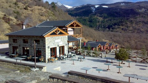
Accommodation
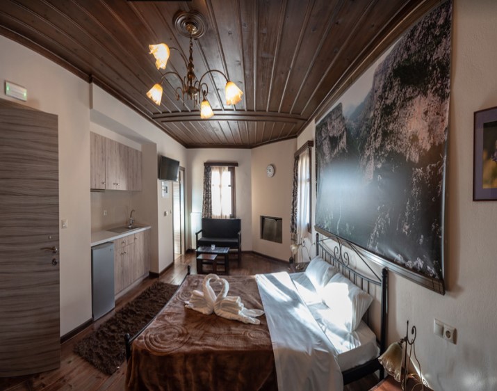
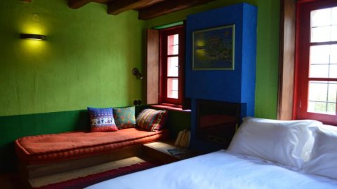
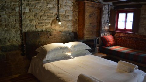
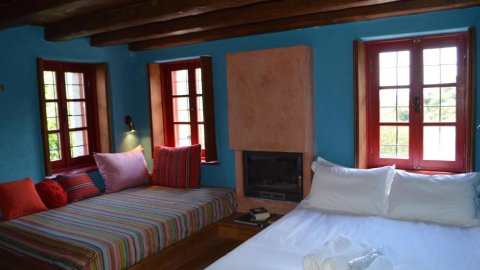
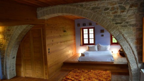
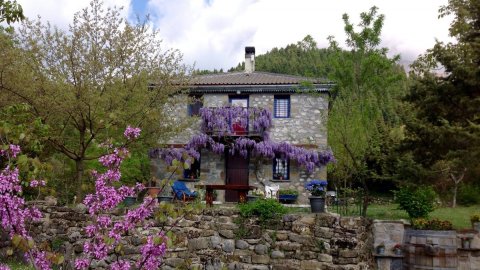
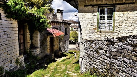
Monodendri: In the beautiful Monodendri, the most famous of the villages of central Zagori, our stay will
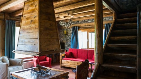
done in a traditional hostel, in double rooms 25 sqm each. Rooms have wooden ceilings and
floors, minibar, TV, private bathroom with shower and free WiFi. Some of them also have a fireplace.
Kalambaka: Our stay in Kalambaka will be in a hotel, in double rooms overlooking the magnificent rocks
of Meteora and the beautiful mountains of central Pindos. Rooms on both floors have a balcony
or window. Each of the rooms has air conditioning / heating and is fully equipped with
necessary amenities (WI-FI, refrigerator, TV, personal care products).
Booking Information
• Registrations until the positions are exhausted - order of priority will be observed
• The reservation is confirmed by depositing the deposit 50% of the total amount over the next 3 days. In
otherwise the position is vacated.
• Payment of the balance no later than 10 days before the day of the tour.
• Refund of the entire amount / deposit in advance for cancellation of participation can be made up to 20
days before the start of the tour.
• Refund of 50% of the amount of money (50% deposit withheld) for cancellation of participation can be made
up to 15 days before the start of the tour.
• Otherwise there is no return due to the planned expenses of the trip.
• 2 nights in a traditional hotel in Monodendri, 1 day stay in
Astraka shelter and 1 day accommodation in a hotel in Kastraki
• Breakfast every day
• Max group size: 20
• Via Ferrata
• 3 days hiking
• Climbing
• The necessary equipment for Via Ferrta and for climbing
• Greek International Mountain Guide
• Quality photos / videos - taken with a drone
• Organized and coordinated by Adventure Club
• Insurance
What does NOT include:
• Transportation (possibility to move with MINI BUS after discussion)
• Drinks, Meals
• Various personal expenses
Meeting Point:
If you are leaving Athens, the meeting point will be arranged with your guide.
If you are close to the excursion areas, the meeting point will be in Konitsa.
In both cases, the exact meeting point will be arranged with your driver.
Equipment List
Day Backpack 30 - 40 liters
• Hiking shoes
• Socks (preferably woolen)
• Underwear
• Hiking pants
• Waterproof Jacket
• Isothermal
• Fleece Jacket
• Hiking poles
• Gloves
• Hat / Buff
• Sunglasses
• Sun cream
• Personal hygiene items
• Water bag or water bottles
• Electrolytes / dry food
• Headlamp / extra batteries
• Private pharmacy
Accommodation
Monodendri: In the beautiful Monodendri, the most famous of the villages of central Zagori, our stay will
done in a traditional hostel, in double rooms 25 sqm each. Rooms have wooden ceilings and
floors, minibar, TV, private bathroom with shower and free WiFi. Some of them also have a fireplace.
Kalambaka: Our stay in Kalambaka will be in a hotel, in double rooms overlooking the magnificent rocks
of Meteora and the beautiful mountains of central Pindos. Rooms on both floors have a balcony
or window. Each of the rooms has air conditioning / heating and is fully equipped with
necessary amenities (WI-FI, refrigerator, TV, personal care products).
Booking Information
• Registrations until the positions are exhausted - order of priority will be observed
• The reservation is confirmed by depositing the deposit 50% of the total amount over the next 3 days. In
otherwise the position is vacated.
• Payment of the balance no later than 10 days before the day of the tour.
• Refund of the entire amount / deposit in advance for cancellation of participation can be made up to 20
days before the start of the tour.
• Refund of 50% of the amount of money (50% deposit withheld) for cancellation of participation can be made
up to 15 days before the start of the tour.
• Otherwise there is no return due to the planned expenses of the trip.
Photos & Videos
0 Reviews
0
 from 80 €
Traditional Guesthouse Kato Pedina Zagori
Kato Pedina, Zagori, Epirus
15 sq. m
3 persons
1 bed
1 bed
Yes
 from 90 €
Traditional Guesthouse Zagori Kato Pedina
Kato Pedina, Zagori, Epirus
26 sq. m
3 persons
1 bed
1 bed
1 rooms
Yes
 from 85 €
Guesthouse Traditional Kato Pedina Zagori
Kato Pedina, Zagori, Epirus
18 sq. m
4 persons
2 beds
1 rooms
Yes
 from 110 €
Traditional Suite Kato Pedina Zagori
Kato Pedina, Zagori, Epirus
35 sq. m
4 persons
1 bed
2 beds
1 rooms
Yes
 from 55 €
 from 185 €
 from 100 €
 from 140 €
 from 150 €
 from 20 €
Refuge Guesthouse Melissourgoi Tzoumerka , Pindos
Melissourgi, Tzoumerka, Pindos Epirus
35 persons
35 beds
Yes
 from 100 €
 from 1140 €
 from 60 €
Hiking Alpin Lake Drakolimni Tymfi,Papingo Epirus
Drakolimni Papigo Zagori Zagorochoria Epirus GReece
8 hrs
 from 139 €
 from 65 €
 from 65 €
 from 50 €
 from 30 €
 from 60 €
Smolikas Dragon Lake: Hiking & 4x4 OffRoad Safari
Zagori-Smolikas Zagorochoria Pindus Epirus Greece
7 hrs
 from 42 €
 from 50 €
 from 200 €
 from 55 €
 from 60 €
 from 55 €
 from 45 €
Hiking in the Stone Villages of Zagori Epirus
Zagori Zagorochoria Pindus Epirus Greece
6 hrs 30 mins
 from 70 €
 from 95 €
Paragliding Tandem Flights Zagori (Zagorochoria)
Aspraggeloi Zagori Zagorocoria Epirus Greece
10-15 λεπτά
 from 80 €
 from 60 €